
Climate change is increasingly reshaping where and how people live. As storms, floods, heat waves, and other climate-related disasters become more frequent and severe, many communities are being forced to move from high-risk areas to new settlement locations. Relocation is often presented as a protective strategy, especially for vulnerable populations who have already experienced severe disaster impacts. However, relocation does not automatically mean safety. If resettlement sites are not carefully planned, internally displaced people may continue to face environmental hazards, limited infrastructure, and inadequate access to emergency services.
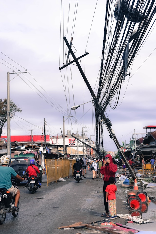
The case of climate-induced displacement in the Philippines illustrates this challenge. After devastating storms and floods, thousands of families have been relocated to new communities intended to provide safer living conditions. Yet recent research suggests that some of these resettlement areas remain exposed to climate-related risks, raising important questions about the effectiveness of relocation as a climate adaptation strategy. This issue highlights the need for stronger integration of geospatial mapping, urban design, community resilience, and long-term disaster management planning.
What happens when people displaced by climate-induced disasters are relocated—but not necessarily to safer places?
In the Philippines, thousands of families have been relocated after devastating storms and floods that are induced by climate change. These individuals, known as internally displaced people (IDPs), are often resettled in new communities meant to protect them from future risks. But recent research shows that relocation alone does not guarantee safety (Kim & Chadduck, 2025). In fact, some communities still face high exposure to flooding, extreme heat, and limited access to emergency services. This raises an important question: are we truly reducing risk, or simply moving it?
How can mapping technologies help us better understand climate risks?
One powerful tool is geospatial mapping. By combining satellite data, flood modeling, and urban heat analysis, researchers can visualize risks that are otherwise invisible. For example, maps can show where floodwaters are most likely to accumulate, where temperatures are dangerously high, and how close communities are to hospitals or emergency shelters. In the case of Tacloban in the Philippines, mapping revealed that some IDP communities are located near urban heat hotspots and flood-prone areas, despite being designed as safer alternatives. This type of spatial analysis is important because it provides evidence that can guide better decision-making. Rather than relying only on general assumptions about safety, geospatial mapping allows policymakers to evaluate whether relocation sites are truly suitable for long-term settlement. It also helps identify where additional investments—such as drainage systems, green spaces, emergency facilities, or improved transportation access—may be needed.
Why does urban design matter for resilience?
Urban design plays a major role in determining whether a relocated community can withstand climate impacts. The way a community is built—including its roads, housing layout, green spaces, drainage systems, and public infrastructure—can either reduce or intensify environmental risks. For example, areas with more vegetation and open space tend to stay cooler and absorb floodwater more effectively. In contrast, densely built neighborhoods with limited green space, poor drainage, and large amounts of paved surfaces can worsen both heat exposure and flooding.
In the Tacloban case, communities with better access to emergency facilities and more green space were noticeably less vulnerable. This shows that resilience is not only about where people are relocated, but also about how the new community is designed and supported. A relocation site may be geographically farther from the original disaster zone, but if it lacks adequate infrastructure, emergency services, or environmental buffers, it may still expose residents to serious risks.
What role do people and communities play in resilience?
Resilience is not only physical—it is also social. Communities with strong social networks, access to public services, and trust among residents are better able to prepare for and respond to disasters. Researchers often call this “social capital (Aldrich & Meyer, 2015).” In Tacloban, areas with more emergency facilities and stronger community infrastructure were better equipped to handle risks. This suggests that resilience must involve both the built environment and the social environment. People need not only safer housing and infrastructure, but also access to support systems, communication networks, local leadership, and public services.
What does this mean for disaster management and climate adaptation policies in developing countries?
Across many developing countries, climate adaptation strategies—such as relocation, infrastructure investment, and disaster risk reduction—are often implemented under resource constraints and urgent timelines. However, the Tacloban case highlights a critical gap: without integrating data-driven risk mapping, urban planning, and community-based approaches, well-intentioned policies may fall short. Effective disaster management and climate adaptation policies must go beyond short-term responses and prioritize long-term resilience by aligning spatial data, governance systems, and local capacities. This includes embedding climate risk assessments into resettlement planning, strengthening emergency response systems, and ensuring that vulnerable populations are not disproportionately exposed to new risks.
Conclusion
The case of internally displaced communities in Tacloban demonstrates that relocation, while often framed as a necessary climate adaptation strategy, does not automatically produce safety or resilience. Rather, relocation can reproduce or even intensify vulnerability when resettlement sites are selected without careful consideration of environmental exposure, infrastructure capacity, emergency access, and social conditions. This finding underscores a central challenge in climate adaptation policy: reducing disaster risk requires more than physically moving populations away from hazard-prone areas; it requires ensuring that new settlements are designed, governed, and supported in ways that meaningfully reduce long-term vulnerability.
The integration of geospatial mapping, urban design, and community-based resilience planning offers an important pathway for improving climate-induced relocation policies.
For developing countries facing increasing climate-related displacement, the policy implication is clear: relocation should not be treated as an endpoint of disaster recovery, but as part of a broader, evidence-based adaptation process. Effective climate adaptation must combine scientific risk assessment with inclusive planning and sustained investment in both physical and social infrastructure. Only through this integrated approach can relocation become a transformative strategy for resilience rather than a mechanism that merely shifts vulnerability from one place to another.
Source:
Kim, Y., & Chadduck, C. 2025. Are Internally Displaced People (IDPs) Safe? A Geospatial Analysis of Climate Vulnerability for IDP Communities in Tacloban, Philippines. Climate, 13(9), 185. https://doi.org/10.3390/cli13090185
Aldrich, D.P. & Meyer, M.A. 2015. Social capital and community resilience. Am. Behav. Sci. 59, 254–269.